


190-00498-07 Rev A
Garmin G1000 Pilot’s Guide for Cessna Nav III
489
ADDITIONAL FEATURES
SYSTEM
OVERVIEW
FLIGHT
INSTRUMENTS
EIS
AUDIO PANEL
& CNS
FLIGHT
MANAGEMENT
HAZARD
AVOIDANCE
AFCS
ADDITIONAL
FEATURES
APPENDICES INDEX
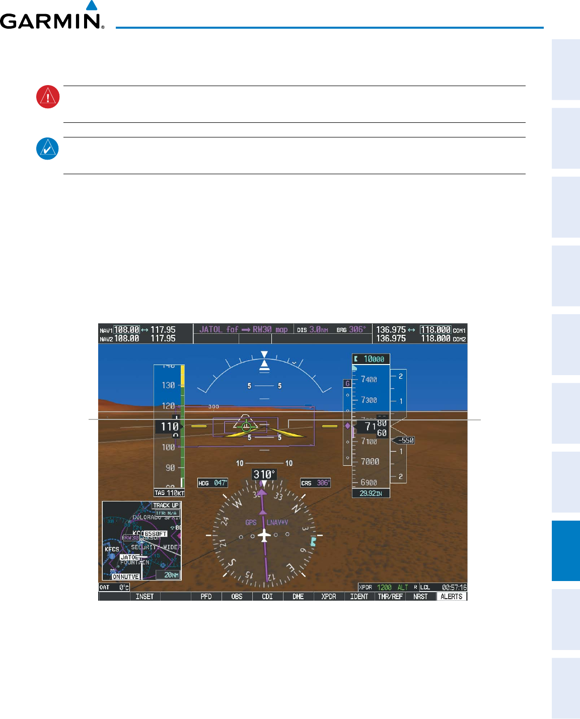
RUNWAYS
WARNING:
Do not use SVS runway depiction as the sole means for determining the proximity of the aircraft
to the runway or for maintaining the proper approach path angle during landing.
NOTE: Not all airports have runways with endpoint data in the database, therefore, these runways are not
displayed.
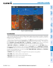
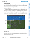
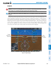
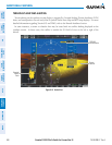
Runwaydataprovidesimprovedawarenessofrunwaylocationwithrespecttothesurroundingterrain.All
runwaythresholdsaredepictedattheirrespectiveelevationsasdenedinthedatabase.Insomesituations,
where threshold elevations differ significantly, crossing runways may appear to be layered. As runways are
displayed,thosewithin45degreesoftheaircraftheadingaredisplayedinwhite.Otherrunwayswillbegray
incolor.Whenanapproachforaspecicrunwayisactive,thatrunwaywillappearbrighterandbeoutlined
with a white box, regardless of the runway orientation as related to aircraft heading. As the aircraft gets closer
to the runway, more detail such as runway numbers and centerlines will be displayed.
Other
Runway
on Airport
Figure 8-9 Airport Runways
Runway
Selected for
Approach