Garmin G1000 Pilot’s Guide for Cessna Nav III
190-00498-07 Rev. A
SYSTEM
OVERVIEW
FLIGHT
INSTRUMENTS
EIS
AUDIO PANEL
& CNS
FLIGHT
MANAGEMENT
HAZARD
AVOIDANCE
AFCS
ADDITIONAL
FEATURES
APPENDICESINDEX
362
HAZARD AVOIDANCE
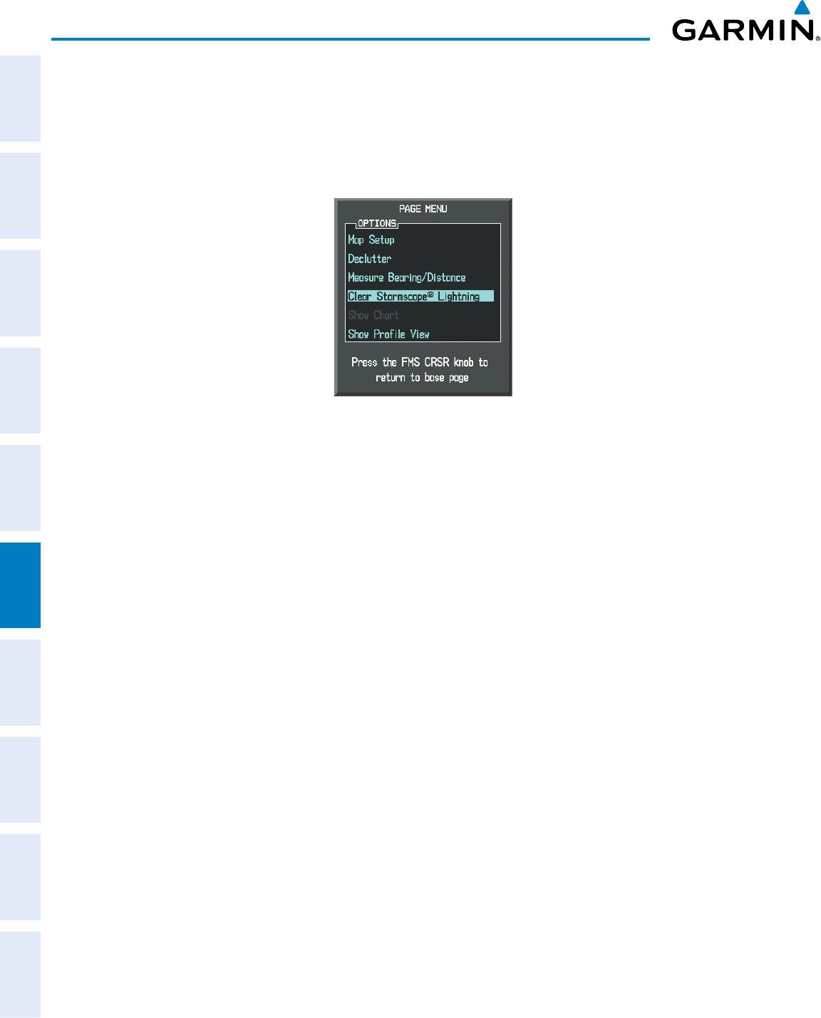
Manually clearing Stormscope data on the Navigation Map:
1) Press the
MENU
Key.
2) Select ‘Clear Stormscope
®
Lightning’.
3) Press the
ENT
Key.
Figure 6-113 Navigation Map Page Options Menu
ZOOM RANGE ON THE NAVIGATION MAP
Stormscopelightningdatacanbedisplayedupto800nmzoomrange(inNorthupmode)ontheNavigation
MapPage.
However, in the track up mode at the 500 nm range, a portion of Stormscope lightning data
can be behind the aircraft and therefore not visible on the Navigation Map
.SincetherangeforStormscope
datais400nmdiametertotal(200nminfrontand200nmbehind),the500nmrangeinNorthupmode
shows all the data.
Atamaprangeoflessthan25nm,Stormscopelightningdataisnotdisplayed,butcanstillbepresent.
ThemaximumzoomrangecanalsobesetontheNavigationMap.NotethatStormscopedataabovethe
selectedmaximumzoomrangeisdecluttered.
Selecting a Stormscope range on the Navigation Map:
1) Press the MENU Key.
2) Select ‘MAP SETUP’.
3) Select the ‘Weather’ group.
4) Press the ENT Key.
5) Turn the
large FMS
Knob to select ‘STRMSCP SMBL’.
6) Turn the
small FMS
Knob to select the maximum display range.
7) Press the
ENT
Key.
8) Press the
FMS
Knob to return to the Navigation Map Page.
TochangethedisplayrangeontheNavigationMapPage,turntheRANGE Knobclockwisetozoomoutor
counter-clockwisetozoomin.