


Garmin G1000 Pilot’s Guide for Cessna Nav III
190-00498-07 Rev. A
SYSTEM
OVERVIEW
FLIGHT
INSTRUMENTS
EIS
AUDIO PANEL
& CNS
FLIGHT
MANAGEMENT
HAZARD
AVOIDANCE
AFCS
ADDITIONAL
FEATURES
APPENDICESINDEX
382
HAZARD AVOIDANCE
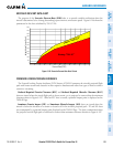
pressure,temperature,andlapserateshavexedvalues),itiscommonforthebaro-correctedaltitude(asread
fromthealtimeter)todifferfromtheGSLaltitude.Thisvariationresultsintheaircraft’sGSLaltitudediffering
fromthebaro-correctedaltitude.
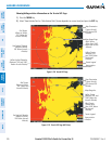
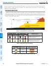
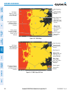
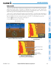
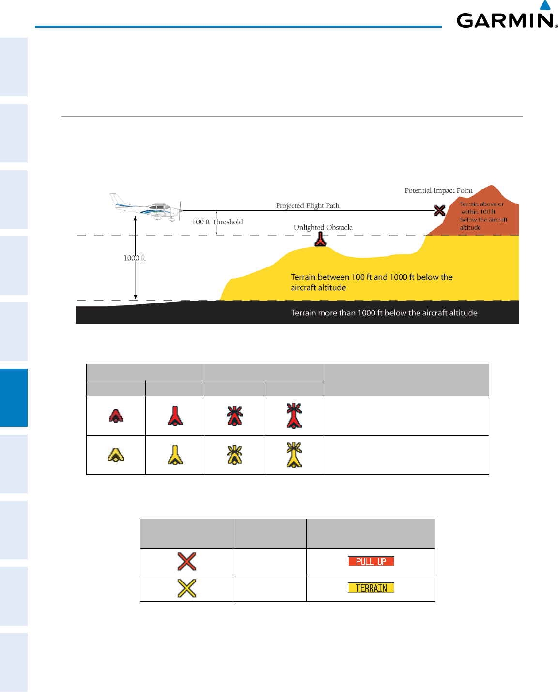
DISPLAYING TAWS-B DATA
TAWS-Busesyellow(caution)andred(warning)todepictterrainandobstacles(withheightsgreaterthan
200feetabovegroundlevel,AGL)alertsrelativetoaircraftaltitude.Colorsareadjustedautomaticallyasthe
aircraftaltitudechanges.Thecolorsandsymbolsinthegureandtablesbelowareusedtorepresentterrain,
obstacles, and potential impact points.
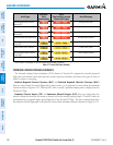
Figure 6-136 Terrain Altitude/Color Correlation for TAWS
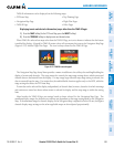
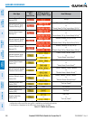
Unlighted Obstacle Lighted Obstacle
Obstacle Location
< 1000’ AGL > 1000’ AGL < 1000’ AGL > 1000’ AGL
Red obstacle is above or within 100 ft
below the aircraft altitude
Yellow obstacle is between 100 ft and
1000 ft below the aircraft altitude
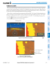
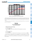
Table 6-19 TAWS-B Obstacle Colors and Symbology
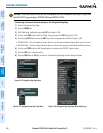
Potential Impact
Point Symbol
Alert Type Example Annunciation
Warning
Caution
Table 6-20 TAWS-B Potential Impact Point Symbols with Alert Types