


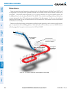
Garmin G1000 Pilot’s Guide for Cessna Nav III
190-00498-07 Rev A494
ADDITIONAL FEATURES
SYSTEM
OVERVIEW
FLIGHT
INSTRUMENTS
EIS
AUDIO PANEL
& CNS
FLIGHT
MANAGEMENT
HAZARD
AVOIDANCE
AFCS
ADDITIONAL
FEATURES
APPENDICESINDEX
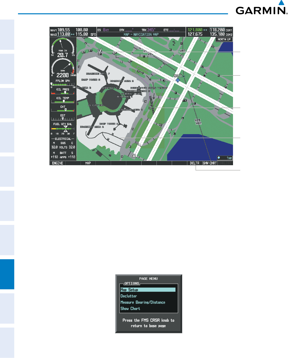
DCLTR
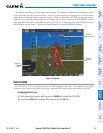
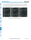
Softkey
Removes Taxiway
Markings
Airport
Features
Taxiway
Identification
Airport Hot
Spot Outline
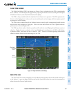
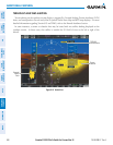
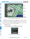
Figure 8-14 SafeTaxi Depiction on the Navigation Map Page
Aircraft
Position
The DCLTRSoftkey(declutter)labeladvancestoDCLTR-1,DCLTR-2,andDCLTR-3eachtimethesoftkeyis
pressed for easy recognition of decluttering level. Pressing the DCLTRSoftkeyremovesthetaxiwaymarkingsand
airport feature labels. Pressing the DCLTR-1SoftkeyremovesVORstationID,theVORsymbol,andintersection
names if within the airport plan view. Pressing the DCLTR-2Softkeyremovestheairportrunwaylayout,unless
the airport in view is part of an active route structure. Pressing the DCLTR-3Softkeycyclesbacktotheoriginal
mapdetail.RefertoMapDeclutterLevelsintheFlightManagementSection.
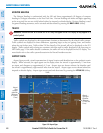
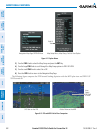
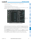
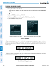
Configuring SafeTaxi range:
1) While viewing the Navigation Map Page, press the MENU Key to display the PAGE MENU.
2) Turn the large
FMS
Knob to highlight the Map Setup Menu Option and press the
ENT
Key.
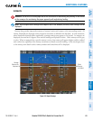
Figure 8-15 Navigation Map PAGE MENU, Map Setup Option