


190-00498-07 Rev. A
Garmin G1000 Pilot’s Guide for Cessna Nav III
177
FLIGHT MANAGEMENT
SYSTEM
OVERVIEW
FLIGHT
INSTRUMENTS
EIS
AUDIO PANEL
& CNS
FLIGHT
MANAGEMENT
HAZARD
AVOIDANCE
AFCS
ADDITIONAL
FEATURES
APPENDICES INDEX
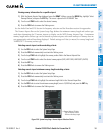
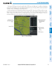
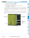
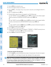
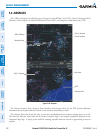
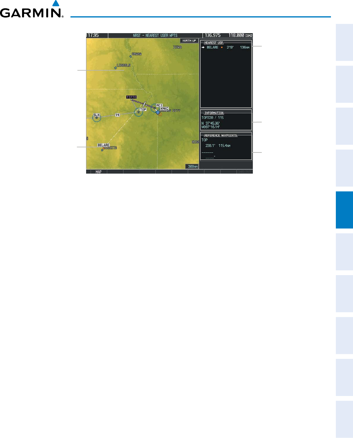
Figure 5-46 Nearest User Waypoint Page
Selected User
Waypoint
Navigation Map
Showing Selected
User Waypoint
Nearest User Wpt List
- Identifier
- Bearing/Distance from
aircraft position
User Waypoint Info
- Comment
- Lat/Long
Reference Wpt Info
- Identifier
- Radial/Distance
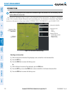
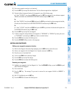
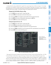
CREATING USER WAYPOINTS
User waypoints can be created from the User Waypoint Information Page in the following ways:
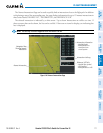
Creating user waypoints from the User Waypoint Information Page:
1) Select the NEW Softkey, or press the MENU Key and select ‘Create New User Waypoint’.
2) Enter a user waypoint name (up to six characters).
3) Press the ENT Key. The current aircraft position is the default location of the new waypoint.
4) If desired, define the type and location of the waypoint in one of the following ways:
a) Select “RAD/RAD” using the small FMS Knob, press the ENT Key, and enter the two reference waypoint
identifiers and radials into the REFERENCE WAYPOINTS window using the FMS Knobs.
Or:
b) Select “RAD/DIS” using the small FMS Knob, press the ENT Key, and enter the reference waypoint identifier,
the radial, and the distance into the REFERENCE WAYPOINTS window using the FMS Knobs.
Or:
c) Select “LAT/LON” using the small FMS Knob, press the ENT Key, and enter the latitude and longitude into
the INFORMATION window using the FMS Knobs.
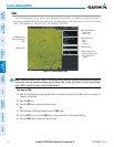
5) Press the ENT Key to accept the new waypoint.
6) If desired, change the storage method of the waypoint to “TEMPORARY” or “NORMAL” by moving the cursor
to “TEMPORARY” and selecting the ENT Key to check or uncheck the box.
7) Press the FMS Knob to remove the flashing cursor.
Or: