


Garmin G1000 Pilot’s Guide for Cessna Nav III
190-00498-07 Rev. A
SYSTEM
OVERVIEW
FLIGHT
INSTRUMENTS
EIS
AUDIO PANEL
& CNS
FLIGHT
MANAGEMENT
HAZARD
AVOIDANCE
AFCS
ADDITIONAL
FEATURES
APPENDICESINDEX
370
HAZARD AVOIDANCE
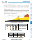
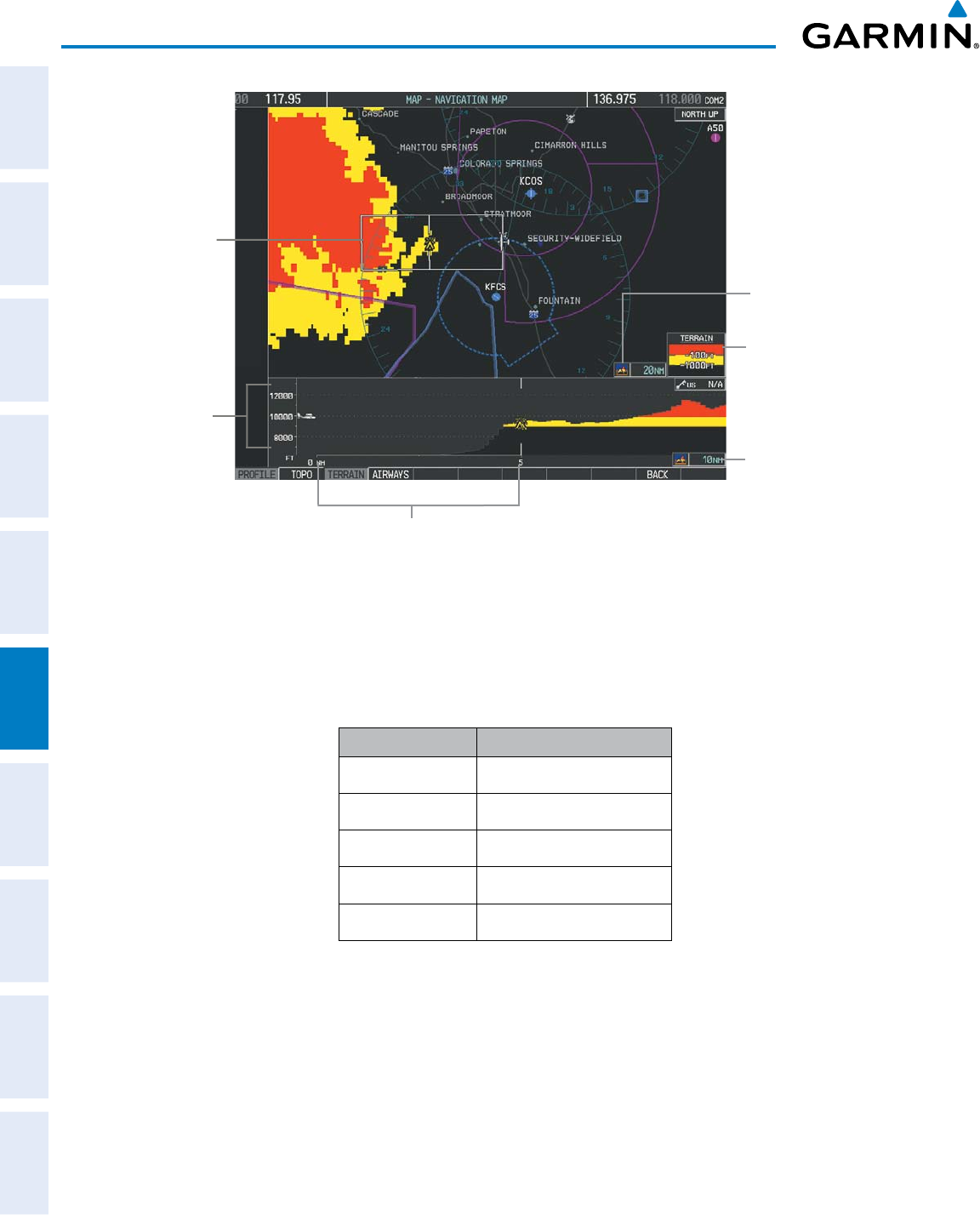
Altitude Scale
Profile View
Path Enabled
Terrain Legend
Profile View Length
is One Half of the
Navigation Map
Range
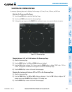
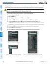
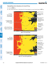
Figure 6-122 Profile View on Navigation Map with Terrain Display Enabled
Distance Scale
Navigation Map Range
TheProleViewisbasedonthecurrentaircrafttrack(orheadingiftrackisunavailable)andshowsthehighest
knownterrainorobstacleswithinapredeterminedwidthfromthepresentaircraftpositiontotheendofthe
prolerange.ThewidthoftheProleView(Table6-14)isdeterminedbythephaseofight,asannunciated
ontheHSI.RefertotheFlightInstrumentssectionformoreinformationaboutightphases.
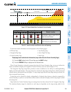
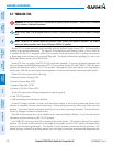
Flight Phase Total Profile View Width
Approach 0.6 nm
Departure 0.6 nm
Terminal 2.0 nm
Enroute 4.0 nm
Oceanic 4.0 nm
Table 6-14 Profile View Width Scale
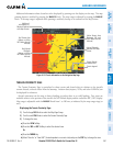
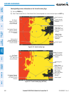
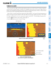
PROFILE PATH
TheProlePath displaysthe horizontalandlateralboundariesoftheProleView.Thepathisshown
asawhiterectangleontheNavigationMapPage(Figure6-122)andisonlyavailablewhenProleViewis
enabled.WhiterangemarkersbothedgesoftheProlePathrectanglematchtherangemarkersalongthe
distancescaleinsidetheProleViewdisplaywindowwhenevertheprolerangeisatleast4nm(or7.5km
ifconguredformetricunits).