


190-00498-07 Rev. A
Garmin G1000 Pilot’s Guide for Cessna Nav III
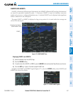
SYSTEM
OVERVIEW
FLIGHT
INSTRUMENTS
EIS
AUDIO PANEL
& CNS
FLIGHT
MANAGEMENT
HAZARD
AVOIDANCE
AFCS
ADDITIONAL
FEATURES
APPENDICES INDEX
327
HAZARD AVOIDANCE
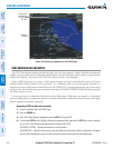
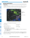
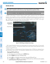
No Radar Coverage
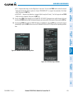
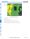
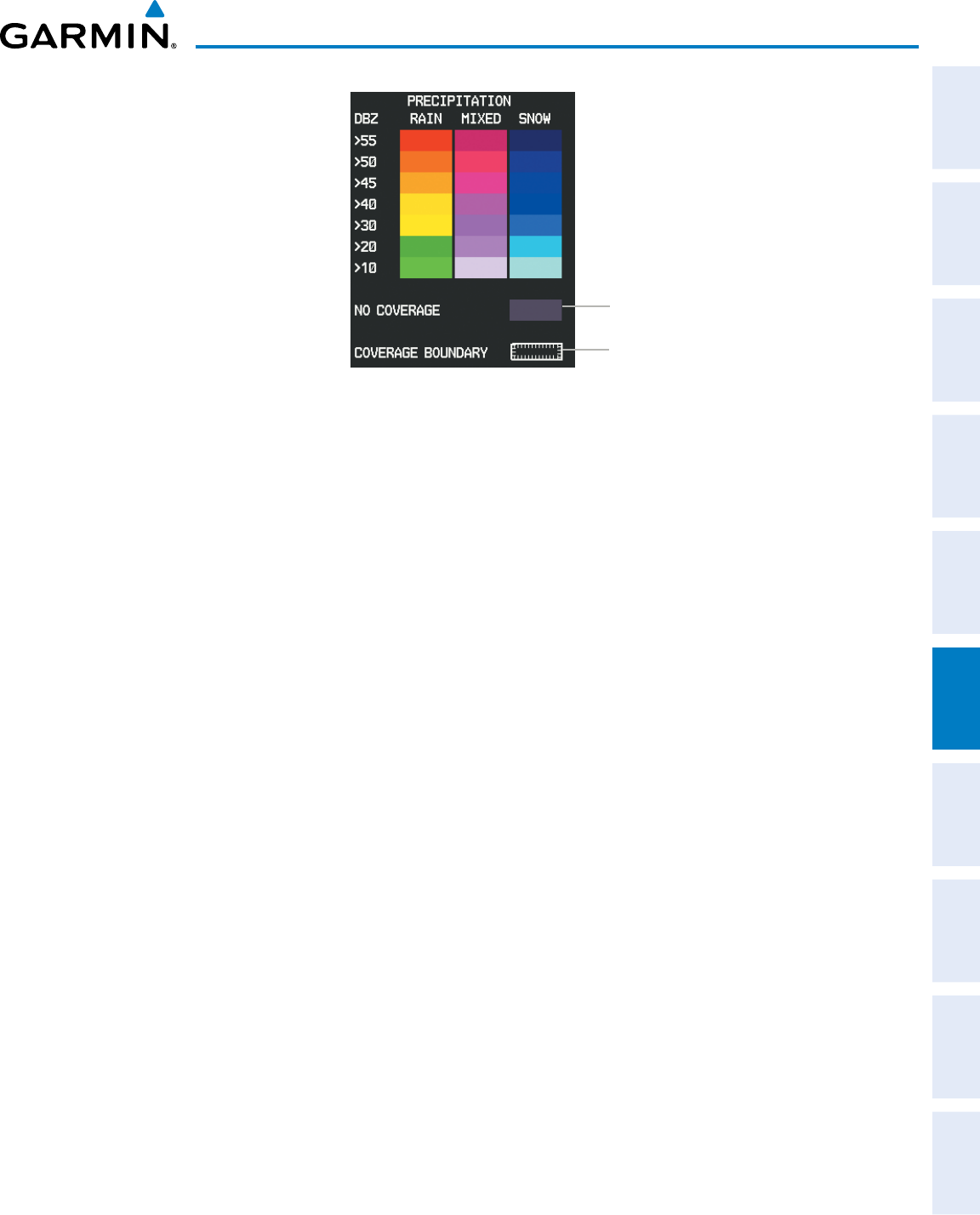
Figure 6-69 Precipitation Data Legend
Boundary of GFDS
weather data request
ThedisplayofradarcoverageisenabledwhenPrecipitationisselectedfordisplay.Areaswhereprecipitation
radarcoverageisnotcurrentlyavailableorisnotbeingcollectedareindicatedingrayshadeofpurple.A
white boundarylinewith whitetickmarks depictstheselected coverage area oftheGFDS weatherdata
request.Thisboundaryenclosestheprecipitationdatawhenthisweatherproductisdisplayed.
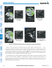
ReFlectivity
Reectivityistheamountoftransmittedpowerreturnedtotheradarreceiver.ColorsonthePrecipitation
displaydirectlycorrelatetothelevelofdetectedreectivity.Reectivityasitrelatestohazardousweather
canbeverycomplex.
Theroleofradarisessentiallytodetectmoistureintheatmosphere.Simplyput,certaintypesofweather
reectradarbetterthanothers.Theintensityofaradarreectionisnotnecessarilyanindicationofthe
weatherhazardlevel.Forinstance,wethailreturnsastrongradarreection,whiledryhaildoesnot.Both
wetanddryhailcanbeextremelyhazardous.
Thedifferentradarechointensitiesaremeasuredindecibels(dB)relativetoreectivity(Z).Weather
radars measure the reflectivity ratio, or the energy reflected
backto
theradarreceiver(
designated by the
letterZ)
.ThevalueofZincreasesasthereturnedsignalstrengthincreases.
PReciPitatiOn limitatiOns
Radarimagesmayhavecertainlimitations:
•Radarbasereectivitydoesnotprovidesufcientinformationtodeterminecloudlayersorprecipitation
characteristics(wethailvs.rain).Forexample,itisnotpossibletodistinguishbetweenwetsnow,wet
hail, and rain.
•Radarbasereectivityissampled atthe minimumantennaelevation angle. Anindividualradar site
cannotdepicthighaltitudestormsatcloseranges.Ithasnoinformationaboutstormsdirectlyoverthe
site.
•Whenzoomedintoarangeof30nm,eachsquareblockonthedisplayrepresentsanareaoffoursquare
kilometers.