


Garmin G1000 Pilot’s Guide for Cessna Nav III
190-00498-07 Rev. A170
FLIGHT MANAGEMENT
SYSTEM
OVERVIEW
FLIGHT
INSTRUMENTS
EIS
AUDIO PANEL
& CNS
FLIGHT
MANAGEMENT
HAZARD
AVOIDANCE
AFCS
ADDITIONAL
FEATURES
APPENDICESINDEX
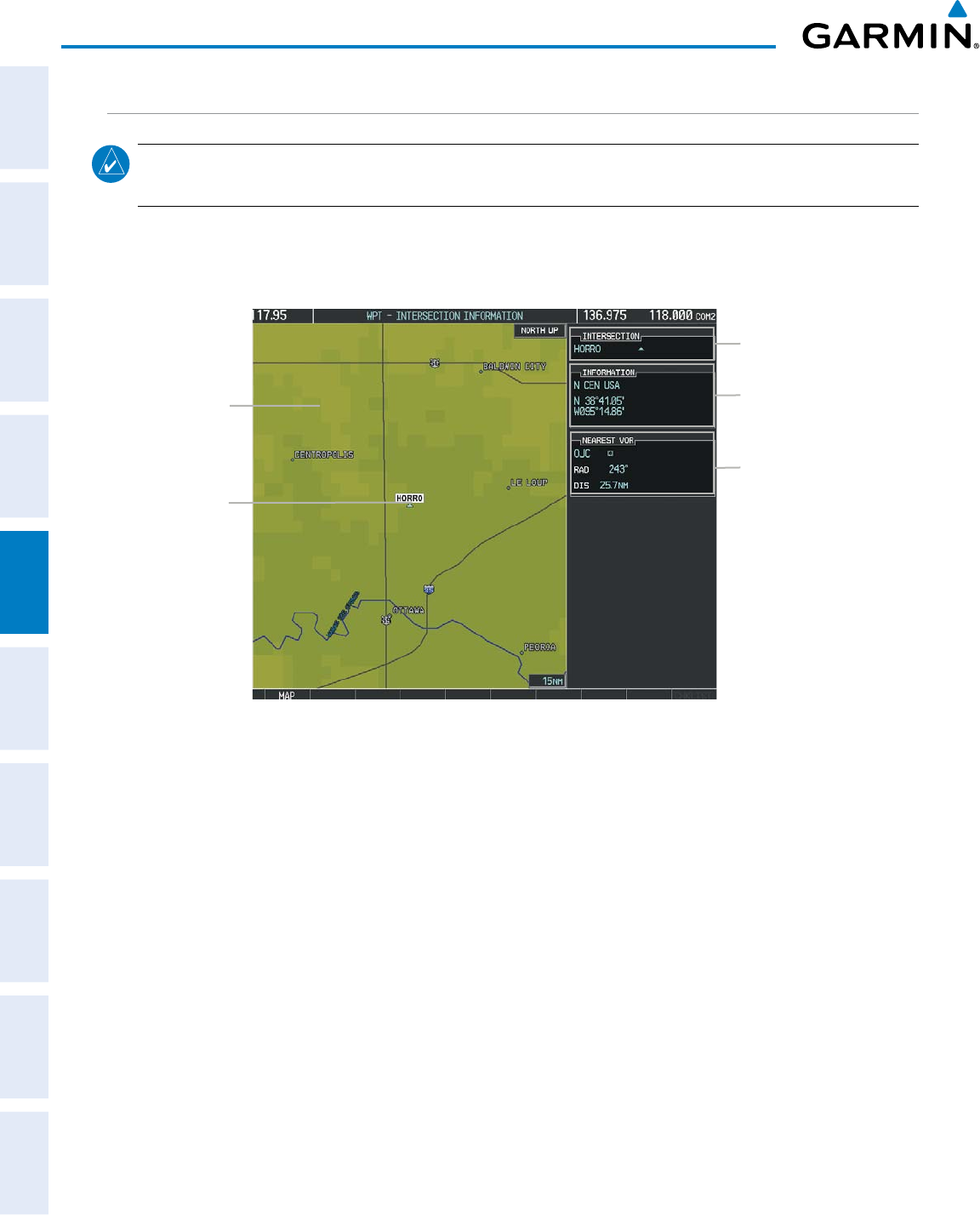
INTERSECTIONS
NOTE: The VOR displayed on the Intersection Information Page is the nearest VOR, not necessarily the VOR
used to define the intersection.
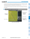
The Intersection Information Page is used to view information about intersections. In addition to displaying
a map of the currently selected intersection and surrounding area, the Intersection Information Page displays
intersectioninformationinthreeboxeslabeled‘INTERSECTION’,‘INFORMATION’,and‘NEARESTVOR’.
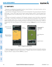
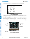
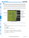
Figure 5-39 Intersection Information Page
Selected
Intersection
Navigation Map
Showing Selected
Intersection
Intersection Identifier
Nearest VOR Info
- Identifier/Type (symbol)
- Radial to VOR
- Distance to VOR
Intersection Info
- Region
- Lat/Long
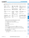
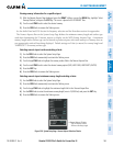
Selecting an intersection:
1) With the Intersection Information Page displayed, enter an identifier in the Intersection Box.
2) Press the ENT Key.
3) Press the FMS
Knob to remove the flashing cursor.
Or:
1) With the Nearest Intersections Page displayed, press the FMS Knob.
2) Press the ENT Key or turn either FMS Knob to select an identifier in the Nearest Intersection Box.
3) Press the FMS Knob to remove the flashing cursor.