


Garmin G1000 Pilot’s Guide for Cessna Nav III
190-00498-07 Rev. A
SYSTEM
OVERVIEW
FLIGHT
INSTRUMENTS
EIS
AUDIO PANEL
& CNS
FLIGHT
MANAGEMENT
HAZARD
AVOIDANCE
AFCS
ADDITIONAL
FEATURES
APPENDICESINDEX
352
HAZARD AVOIDANCE
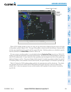
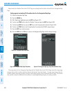
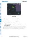
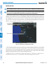
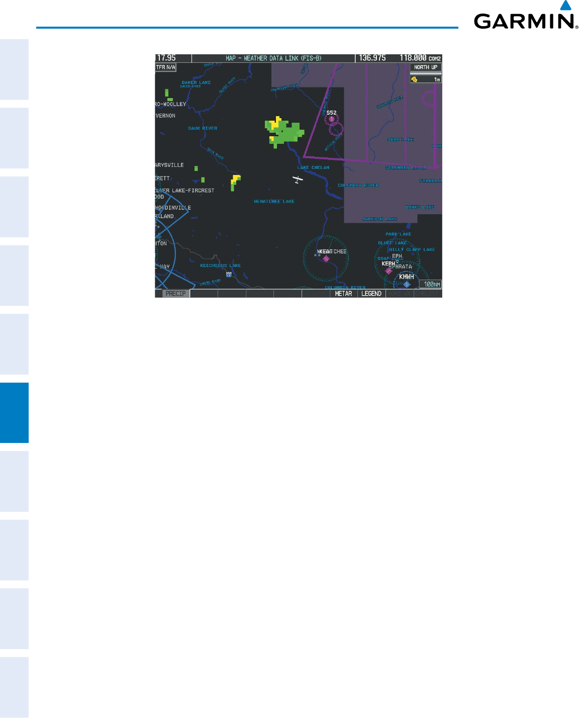
Figure 6-103 Regional Radar Precipitation Data on the Weather
Data Link (FIS-B) Page)
RegionalRadarPrecipitationdatacanbedisplayedonthefollowingmaps:
•PFDInsetMap
•NavigationMapPage
•WeatherDataLink(FIS-B)Page
•AirportInformationPage
•TripPlanningPage
•NearestPages
•FlightPlanPages
•AUX-VideoPage
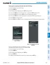
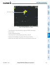
Displaying Regional Radar Precipitation information:
1) Press the MAP Softkey (for the PFD Inset Map, press the INSET Softkey). This step is not necessary on the
Weather Data Link (FIS-B) Page.
2) Press the PRECIP Softkey.
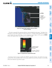
TheRegionalRadarPrecipitationproductcoverageareavaries,asitisdeterminedbythedatareceivedfrom
ground-basedsources.WhentheRegionalRadarPrecipitationproductisenabled,awhitehashedboundary
rectangle encloses this area to indicate the geographic limits of the regional radar coverage being displayed.
ThesystemshowscompositeradardatafromallavailableNEXRADsitesinsideofthisboundaryarea.