


190-00498-07 Rev. A
Garmin G1000 Pilot’s Guide for Cessna Nav III
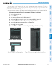
SYSTEM
OVERVIEW
FLIGHT
INSTRUMENTS
EIS
AUDIO PANEL
& CNS
FLIGHT
MANAGEMENT
HAZARD
AVOIDANCE
AFCS
ADDITIONAL
FEATURES
APPENDICES INDEX
307
HAZARD AVOIDANCE
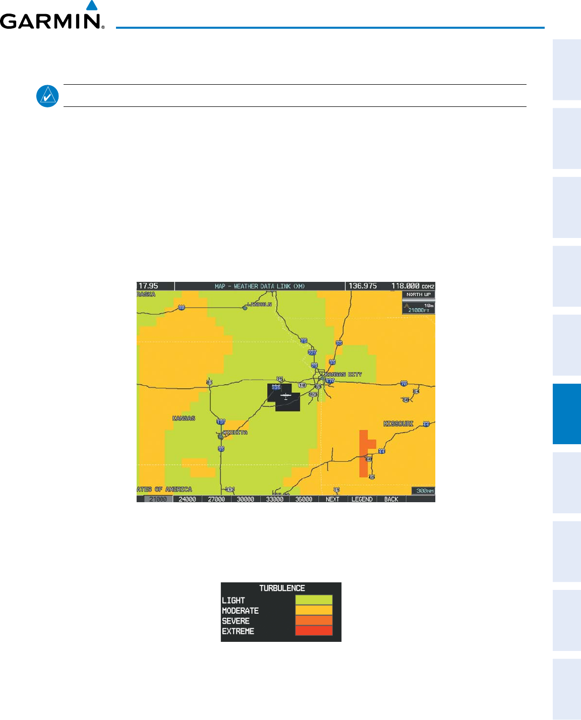
TURBULENCE
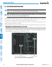
NOTE: Turbulence data cannot be displayed with NEXRAD data.
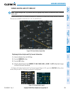
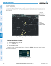
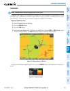
Turbulence data (Figure 6-44) identies the potential for erratic movement of high-altitude air mass
associatedwinds.Turbulenceisclassiedaslight,moderate,severeorextreme,ataltitudesbetween21,000
and45,000feet.TurbulencedataisintendedtosupplementAIRMETsandSIGMETs.
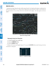
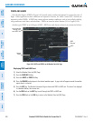
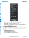
Displaying Turbulence data:
1) Select the Weather Data Link (XM) Page.
2) Press the
MORE WX
Softkey.
3) Press the
TURB
Softkey.
4) Select the desired altitude level: 21,000 feet up to 45,000 feet. Press the
NEXT
or
PREV
Softkey to cycle
through the altitude softkeys. The
TURB
Softkey label changes to reflect the altitude selected.
Figure 6-44 Turbulence Data at 21,000 Feet
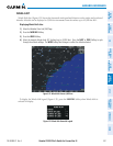
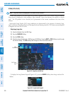
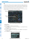
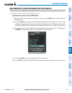
TodisplaytheTurbulencelegend(Figure6-45),pressthe
LEGEND
SoftkeywhenTurbulenceisselectedfor
display.
Figure 6-45 Turbulence Legend