


Garmin G1000 Pilot’s Guide for Cessna Nav III
190-00498-07 Rev. A
SYSTEM
OVERVIEW
FLIGHT
INSTRUMENTS
EIS
AUDIO PANEL
& CNS
FLIGHT
MANAGEMENT
HAZARD
AVOIDANCE
AFCS
ADDITIONAL
FEATURES
APPENDICESINDEX
356
HAZARD AVOIDANCE
METARS AND TAFS
NOTE: Atmospheric pressure is reported in inches of mercury (in Hg). Temperatures are reported in Celsius.
NOTE: The system will begin to display METAR flags as it receives reports; however it may take approximately
ten minutes for all available METAR and TAF data to be received over a FIS-B broadcast.
AviationRoutineWeatherReportsorMETARstypicallycontaincurrentinformationaboutthetemperature,
dewpoint, wind, precipitation, cloud cover, cloud heights, visibility, and barometric pressure at an airport or
observationstation.Theycanalsocontaininformationonprecipitationamounts,lightning,andothercritical
data.METARsreectroutinehourlyobservations.AnAviationSelectedSpecialReportorSPECIincludes
thecode“SPECI”inthereport,andmaybeissuedifcriticalinformationhaschangedaftertheissuanceofa
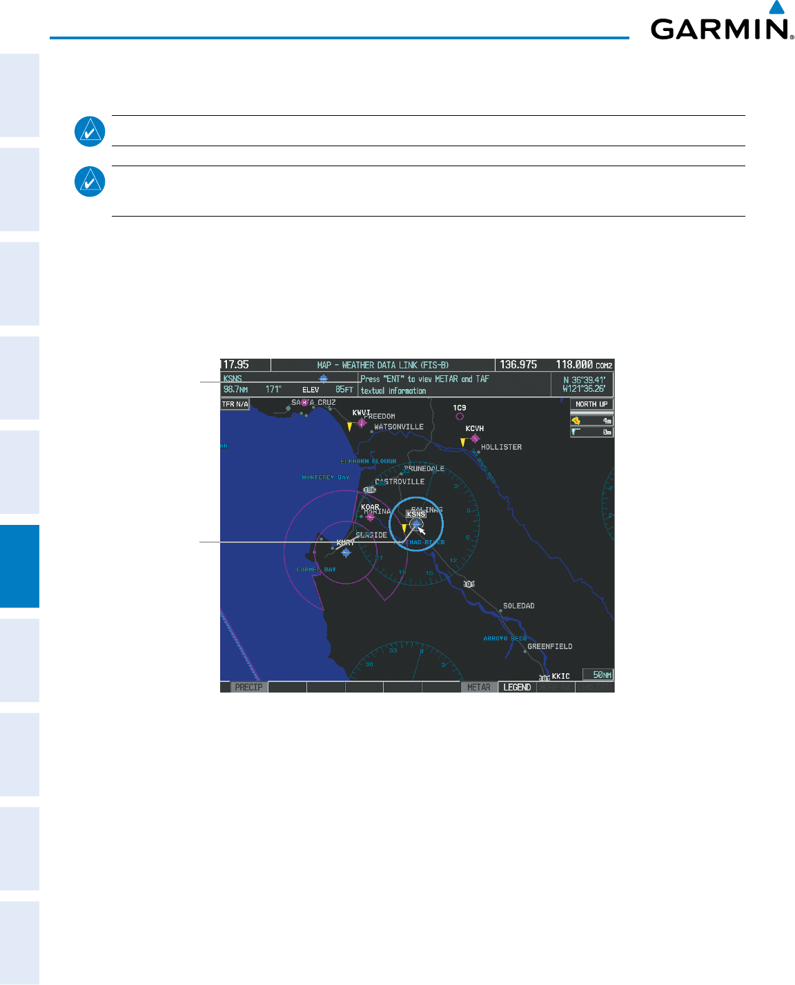
METAR.Thesystemdisplayscoloredagsatairportswithreport(s)available.
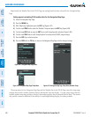
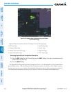
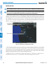
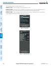
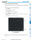
Figure 6-107 METAR Flags on the Weather Data Link Page
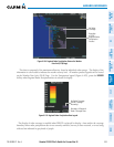
Instructions for
Viewing METAR
and TAF Text
Selected Airport
TAFs(TerminalAerodromeForecasts)arepredicationsofexpectedweatherconditionsforanareawithin
vestatutemilesofthecenterofanairport’srunwaycomplex.TheNationalWeatherServiceissuesscheduled
TAFsfourtimeseachday,andadditionalamendedTAFsifconditionswarrant.TAFstypicallyspanaforecast
periodof24hours,butmaybescheduledforalongerperiod.TAFsmayincludeforecastwind,visibility,
signicantweatherphenomena,andskyconditionsusingMETARcodes.
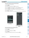
METARandTAFtextareavailableontheWeatherInformationPage.METARdataisdisplayedrstina
decodedfashion,thenasrawtext.TAFinformation,whenavailable,appearsonlyasrawtext.