


190-00498-07 Rev. A
Garmin G1000 Pilot’s Guide for Cessna Nav III
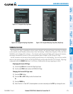
SYSTEM
OVERVIEW
FLIGHT
INSTRUMENTS
EIS
AUDIO PANEL
& CNS
FLIGHT
MANAGEMENT
HAZARD
AVOIDANCE
AFCS
ADDITIONAL
FEATURES
APPENDICES INDEX
383
HAZARD AVOIDANCE
TAWS-Binformationcanbedisplayedonthefollowingmaps:
•PFDInsetMap
•NavigationMapPage
•TAWS-BPage
•TripPlanningPage
•FlightPlanPages
•VideoPages
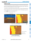
Displaying terrain and obstacle information (maps other than the TAWS-B Page):
1) Press the MAP Softkey (for the PFD Inset Map, press the INSET Softkey).
2) Press the TERRAIN Softkey to display terrain and obstacle data.
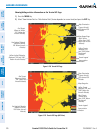
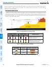
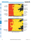
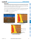
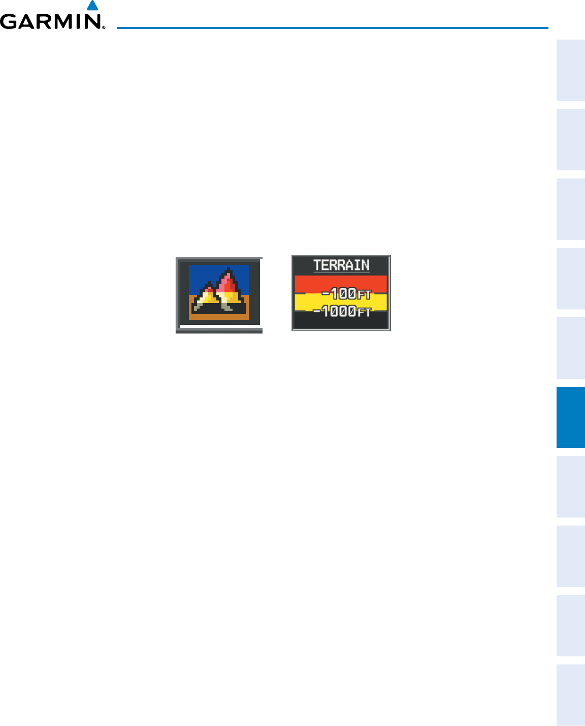
WhenTAWS-BisselectedonmapsotherthantheTAWS-BPage,aniconisshowntoindicatethatthefeature
isenabledfordisplay.AlegendforTAWS-BterraincolorswillaccompanytheiconontheNavigationMapPage
(Figure6-137)andtheFlightPlanPages.TheiconisalwaysshownontheTAWS-BPage.
Figure 6-137 TAWS-B Icon and Legend
TheNavigationMapPageSetupMenuprovidesameansinadditiontothesoftkeysforenabling/disablingthe
displayofterrainandobstacles.Thesetupmenualsocontrolsthemaprangesettingsabovewhichterrainand
obstacledataaredeclutteredfromthedisplay.Ifamaprangelargerthanthemaprangesettingisselected,the
dataisremovedfromthemap.Forterraindata,theenable/disablefunctionappliesonlytotheMFD,whilethe
rangesettingalsoaffectsthePFDInsetMap.
Terraindatacanbeselectedfordisplayindependentlyofobstacledata;however,obstaclesforwhichwarnings
and cautions are issued are shown when terrain is selected for display and the map range is within the setting
limit.
Maps besides the TAWS-BPageusesettings based on those selected for the NavigationMapPage.The
maximumdisplayrangesforobstaclesoneachmaparedependentontherangesettingmadefortheNavigation
Map.IfthemaximumrangeforobstacledisplayontheNavigationMapisadjustedtobelow20nm,thehighest
obstacle display range settings on the other applicable maps are also adjusted proportionally.