


Garmin G1000 Pilot’s Guide for Cessna Nav III
190-00498-07 Rev. A272
FLIGHT MANAGEMENT
SYSTEM
OVERVIEW
FLIGHT
INSTRUMENTS
EIS
AUDIO PANEL
& CNS
FLIGHT
MANAGEMENT
HAZARD
AVOIDANCE
AFCS
ADDITIONAL
FEATURES
APPENDICESINDEX
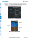
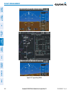
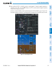
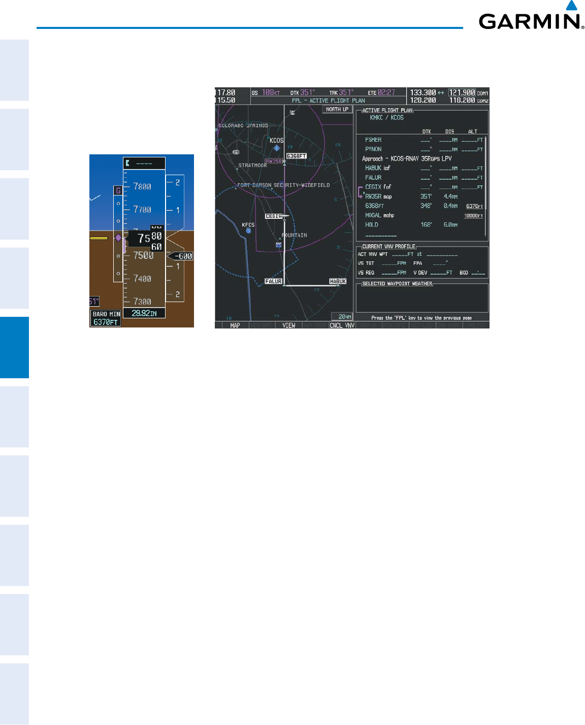
24) After crossing CEGIX, the aircraft continues following the glidepath to maintain the descent to “AT or ABOVE”
6,370 feet at the Missed Approach Point (MAP) (RW35R) as seen in Figure 5-142.
Figure 5-142 Descending to the Missed Approach Point
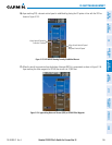
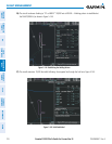
In this missed approach procedure, the altitude immediately following the MAP (in this case ‘6368ft’) is not part
of the published procedure. It is simply a Course to Altitude (CA) leg which guides the aircraft along the runway
centerline until the altitude required to safely make the first turn toward the MAHP is exceeded. This altitude
is provided by Jeppesen, and may be below, equal to, or above the published minimums for this approach. In
this case, if the aircraft altitude is below the specified altitude (6,368 feet) after crossing the MAP, a direct-to
is established to provide a course on runway heading until an altitude of 6,368 feet is reached. After reaching
6,368 feet, a direct-to is established to the published MAHP (in this case MOGAL). If the aircraft altitude is
above the specified altitude after crossing the MAP, a direct-to is established to the published fix (MOGAL) to
begin the missed approach procedure.
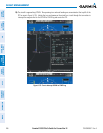
In some missed approach procedures this Course to Altitude leg may be part of the published procedure. For
example, a procedure may dictate a climb to 5,500 feet, then turn left and proceed to the Missed Approach Hold
Point (MAHP). In this case, the altitude would appear in the list of waypoints as ‘5500ft’. Again, if the aircraft
altitude is lower than the prescribed altitude, a direct-to is established on a Course to Altitude leg when the
missed approach procedure is activated.