


190-00498-07 Rev. A
Garmin G1000 Pilot’s Guide for Cessna Nav III
SYSTEM
OVERVIEW
FLIGHT
INSTRUMENTS
EIS
AUDIO PANEL
& CNS
FLIGHT
MANAGEMENT
HAZARD
AVOIDANCE
AFCS
ADDITIONAL
FEATURES
APPENDICES INDEX
367
HAZARD AVOIDANCE
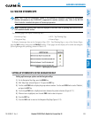
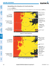
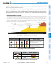
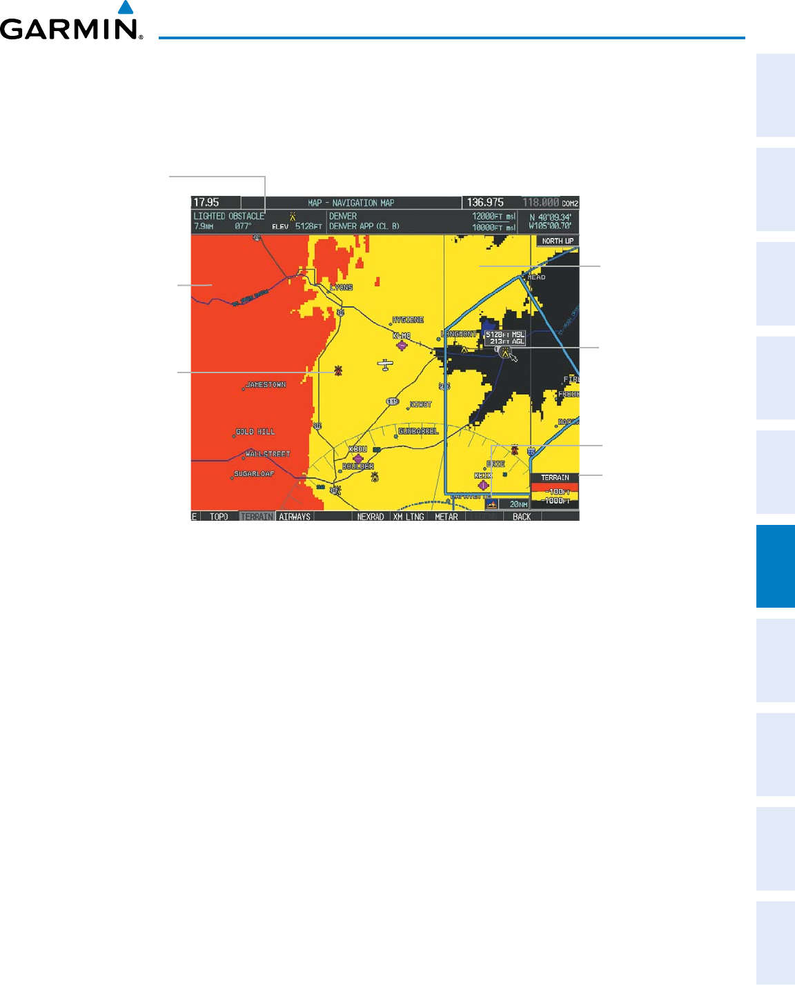
Additionalinformationaboutobstaclescanbedisplayedbypanningoverthedisplayonthemap.Themap
panning feature is enabled by pressing the RANGE Knob.ThemaprangeisadjustedbyturningtheRANGE
Knob.Ifthemaprangeisadjustedwhilepanningisenabled,themapisre-centeredontheMapPointer.
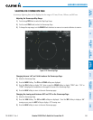
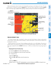
Figure 6-119 Terrain Information on the Navigation Map Page
Additional
Information on
Obstacle Selected
with Map Pointer
Yellow Terrain Area
(Between 100’ and
1000’ Below Aircraft
Altitude)
Red Lighted
Obstacles
(Above or Within
100’ Below Aircraft
Altitude)
Lighted Obstacle
Selected with Map
Pointer
Terrain Legend
Terrain Display
Enabled Icon
Red Terrain Area
(Above or Within
100’ Below Aircraft
Altitude)
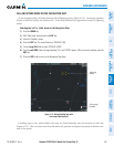
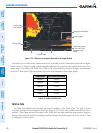
TERRAIN PROXIMITY PAGE
The Terrain ProximityPageisspecialized to show terrain and obstacle datainrelation to theaircraft’s
currentaltitude,withoutclutterfromthebasemap.Aviationdata(airports,VORs,andotherNAVAIDs)can
be displayed for reference.
Aircraftorientation onthis mapis alwaysheading upunless thereis novalid heading. Twoviewsare
availablerelativetothepositionoftheaircraft:the360°defaultdisplayandtheradar-likeARC(120°)display.
MaprangeisadjustablewiththeRANGE Knobfrom1to200nm,asindicatedbythemaprangerings(or
arcs).
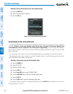
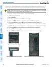
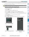
Displaying the Terrain Proximity Page:
1) Turn the large
FMS
Knob to select the Map Page Group.
2) Turn the small
FMS
Knob
to select the Terrain Proximity Page.
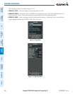
3) To change the view,
a) Press the
VIEW
Softkey.
b) Press the 360 or ARC Softkey to select the desired view.
Or:
a) Press the MENU Key.
b) Select ‘View Arc’ or ‘View 360º’ (choice dependent on current state) and press the ENT Key to change the view.