


190-00498-07 Rev. A
Garmin G1000 Pilot’s Guide for Cessna Nav III
SYSTEM
OVERVIEW
FLIGHT
INSTRUMENTS
EIS
AUDIO PANEL
& CNS
FLIGHT
MANAGEMENT
HAZARD
AVOIDANCE
AFCS
ADDITIONAL
FEATURES
APPENDICES INDEX
375
HAZARD AVOIDANCE
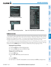
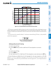
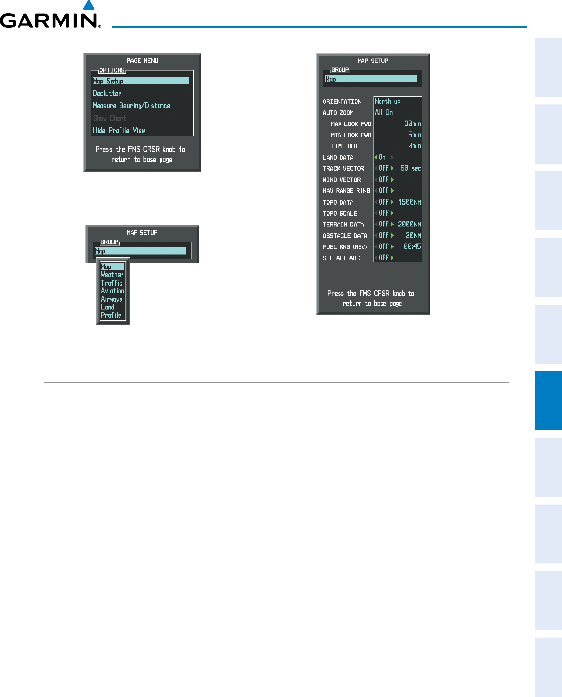
Figure 6-128 Navigation Map Page Setup Menu
Figure 6-127 Navigation Map Page Menu
Figure 6-129 Navigation Map Page Setup Menu, Map Group
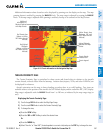
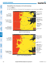
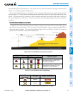
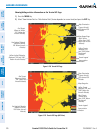
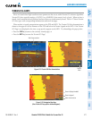
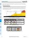
TERRAIN-SVS PAGE
TheTerrain-SVS Pageisspecializedtoshowterrain,obstacle, andpotentialimpactpointdatainrelation
totheaircraft’scurrentaltitude,withoutclutterfromthebasemap.Aviationdata(airports,VORs,andother
NAVAIDs)canbedisplayedforreference.Ifanobstacleandtheprojectedightpathoftheaircraftintersect,
thedisplayautomaticallyzoomsintotheclosestpotentialpointofimpactontheTerrain-SVSPage.
Aircraftorientationonthismapisalwaysheadingupunlessthereisnovalidheading.Twoviewsareavailable
relativetothepositionoftheaircraft:the360°defaultdisplayandtheradar-likeARC(120°)display.Maprange
is adjustable with the RANGE Knobfrom1to200nm,asindicatedbythemaprangerings(orarcs).
Displaying the Terrain-SVS Page:
1) Turn the large
FMS
Knob to select the Map Page Group.
2) Turn the small
FMS
Knob
to select the TERRAIN-SVS Page.
Changing the Terrain-SVS Page view:
1) Press the
VIEW
Softkey.
2) Press the 360 or ARC Softkey to select the desired view.
Or:
1) Press the MENU Key.
2)
Select ‘View Arc’ or ‘View 360º’ (choice dependent on current state) and press the ENT Key to change the view