


Garmin G1000 Pilot’s Guide for Cessna Nav III
190-00498-07 Rev. A138
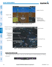
FLIGHT MANAGEMENT
SYSTEM
OVERVIEW
FLIGHT
INSTRUMENTS
EIS
AUDIO PANEL
& CNS
FLIGHT
MANAGEMENT
HAZARD
AVOIDANCE
AFCS
ADDITIONAL
FEATURES
APPENDICESINDEX
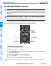
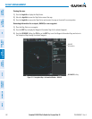
4) Turn the small FMS Knob to select the desired orientation.
5) Press the ENT Key to select the new orientation.
6) Press the FMS Knob to return to the base page.
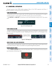
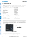
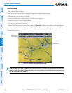
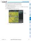
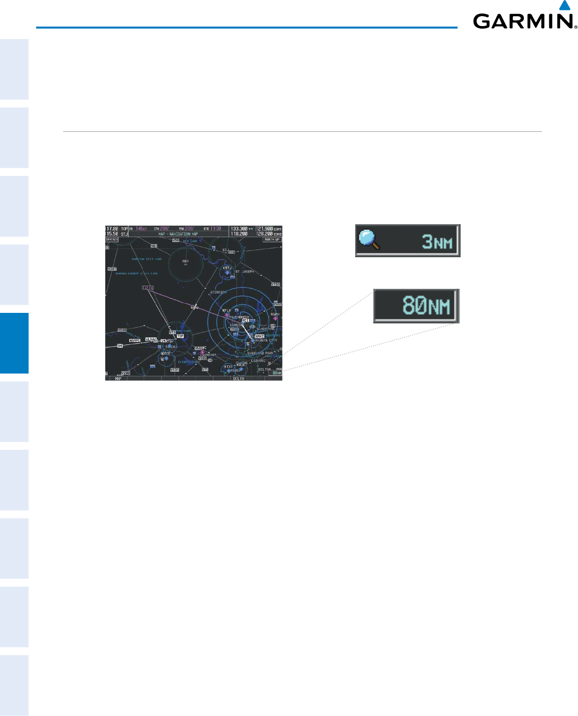
MAP RANGE
There are 28 different map ranges available, from 500 feet to 2000 nm. The current range is indicated in
the lower right corner of the map and represents the top-to-bottom distance covered by the map. When the
map range is decreased to a point that exceeds the capability of the G1000 to accurately represent the map,
a magnifying glass icon is shown to the left of the map range. To change the map range turn the Joystick
counter-clockwise to decrease the range, or clockwise to increase the range.
Figure 5-6 Map Range
Range Overzoom
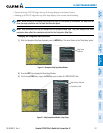
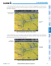
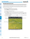
AUTO ZOOM
Auto zoom allows the G1000 to change the map display range to the smallest range clearly showing the
active waypoint. Auto zoom can be overridden by adjusting the range with the Joystick, and remains until
the active waypoint changes, a terrain or traffic alert occurs, the aircraft takes off, or the manual override times
out (timer set on Map Setup Window).
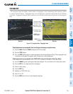
If a terrain caution or warning occurs, any map page displaying TAWS/TERRAIN data automatically adjusts
to the smallest map range clearly showing the highest priority alert. If a new traffic advisory alert occurs, any
map page capable of displaying traffic advisory alerts automatically adjusts to the smallest map range clearly
showing the traffic advisory. When terrain or traffic alerts clear, the map returns to the previous auto zoom
range based on the active waypoint.
The auto zoom function can be turned on or off independently for the PFD and MFD. Control of the ranges
atwhichtheautozoomoccursisdonebysettingtheminimumandmaximum‘lookforward’times(seton
the Map Setup Window for the Map Group). These settings determine the minimum and maximum distance
to display based upon the aircraft’s ground speed.
•Waypointsthatarelongdistancesapartcausethemaprangetoincreasetoapointwheremanydetailson
the map are decluttered. If this is not acceptable, lower the maximum look ahead time to a value that limits
the auto zoom to an acceptable range.
•Waypointsthatareveryshortdistancesapartcausethemaprangetodecreasetoapointwheresituational
awareness may not be what is desired. Increase the minimum look ahead time to a value that limits the auto
zoom to a minimum range that provides acceptable situational awareness.