


Garmin G1000 Pilot’s Guide for Cessna Nav III
190-00498-07 Rev. A174
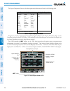
FLIGHT MANAGEMENT
SYSTEM
OVERVIEW
FLIGHT
INSTRUMENTS
EIS
AUDIO PANEL
& CNS
FLIGHT
MANAGEMENT
HAZARD
AVOIDANCE
AFCS
ADDITIONAL
FEATURES
APPENDICESINDEX
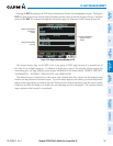
VORS
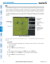
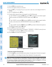
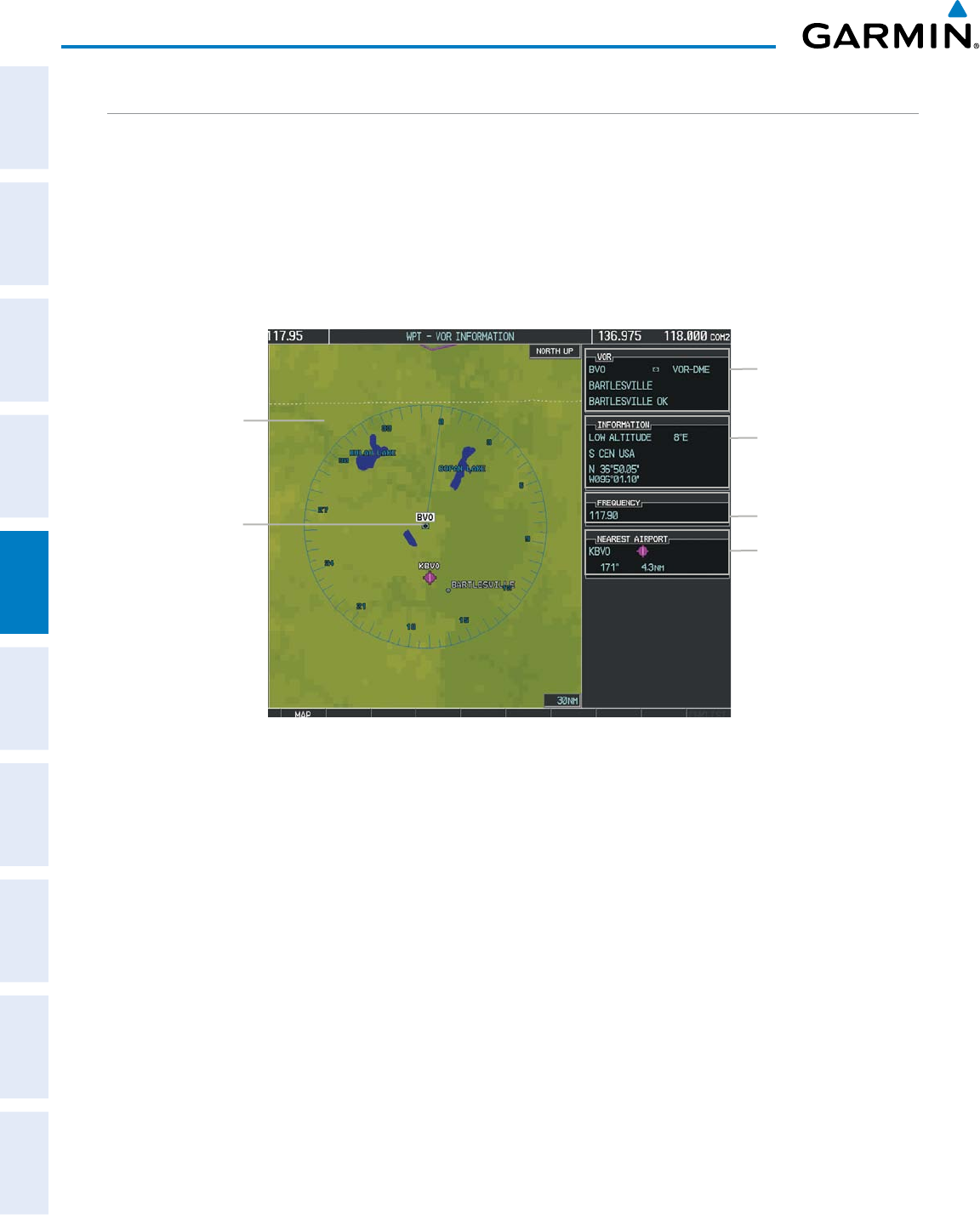
The VOR Information Page can be used to view information about VOR and ILS signals (since ILS signals
canbereceivedonaNAVreceiver),ortoquicklyauto-tuneaVORorILSfrequency.Localizerinformation
cannot be viewed on the VOR Information Page. If a VOR station is combined with a TACAN station it is
listed as a VORTAC on the VOR Information Page and if it includes only DME, it is displayed as VOR-DME.
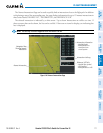
In addition to displaying a map of the currently selected VOR and surrounding area, the VOR Information
PagedisplaysVORinformationinfourboxeslabeled‘VOR’,‘INFORMATION’,‘FREQUENCY’,and‘NEAREST
AIRPORT’.
Figure 5-43 VOR Information Page
Selected VOR
Navigation Map
Showing Selected
VOR
VOR Identifier/Type
- Facility Name
- Nearest City
Nearest Airport Info
- Identifier/Type (symbol)
- Bearing/Distance to
Airport
VOR Information
- Class/Magnetic Variation
- Region
- Lat/Long
VOR Frequency
The VOR classes used in the VOR information box are: LOW ALTITUDE, HIGH ALTITUDE, and
TERMINAL.
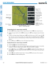
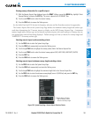
Select a VOR:
1) With the VOR Information Page displayed, enter an identifier, the name of the VOR, or the city in which it’s
located in the VOR Box.
2) Press the ENT Key.
3) Press the FMS Knob to remove the flashing cursor.
Or:
1) With the Nearest VOR Page displayed, press the FMS Knob or press the VOR Softkey.
2) Press the ENT Key or turn either FMS Knob to select an identifier in the Nearest VOR Box.
3) Press the FMS Knob to remove the flashing cursor.
Or: