


Chapter 1: Introduction
12 The Inmarsat BGAN system
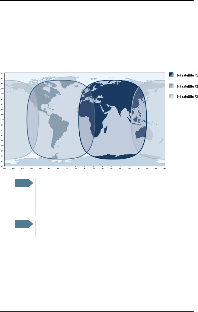
Coverage
The Inmarsat BGAN services are based on geostationary satellites situated
above the equator. Each satellite covers a certain area (footprint). The
coverage map below shows the footprints of the BGAN system.
(Launch planned
for 2008)
Note
The map depicts Inmarsat's expectations of coverage, but does not
represent a guarantee of service. The availability of service at the
edge of coverage areas fluctuates depending on various conditions.
The launch of the F3 satellite (POR) is planned for 2008.
Note
Certain FleetBroadband services are not available in areas with low
elevation. For further information, see Limitations on page 16.
BGAN-X_UM.book Page 12 Wednesday, April 30, 2008 12:48 PM