5 Using GPS
52 Juno ST Handheld User Guide
Using your GPS field software
By default, the handheld is configured to receive satellite signals in most conditions.
This section describes how to use your GPS field software to:
• view available GPS satellites
• plan the best time to collect data
• set up a connection to an SBAS real-time DGPS source
• output NMEA data
The steps and screens in this section describe the TerraSync software, the GPS user
interface of which is similar to that of the GPS Controller software and the Trimble
GPScorrect extension for ESRI ArcPad software. The exact steps for your GPS field
software may differ depending on the GPS field software you are using.
For more information, refer to the documentation for your GPS field software.
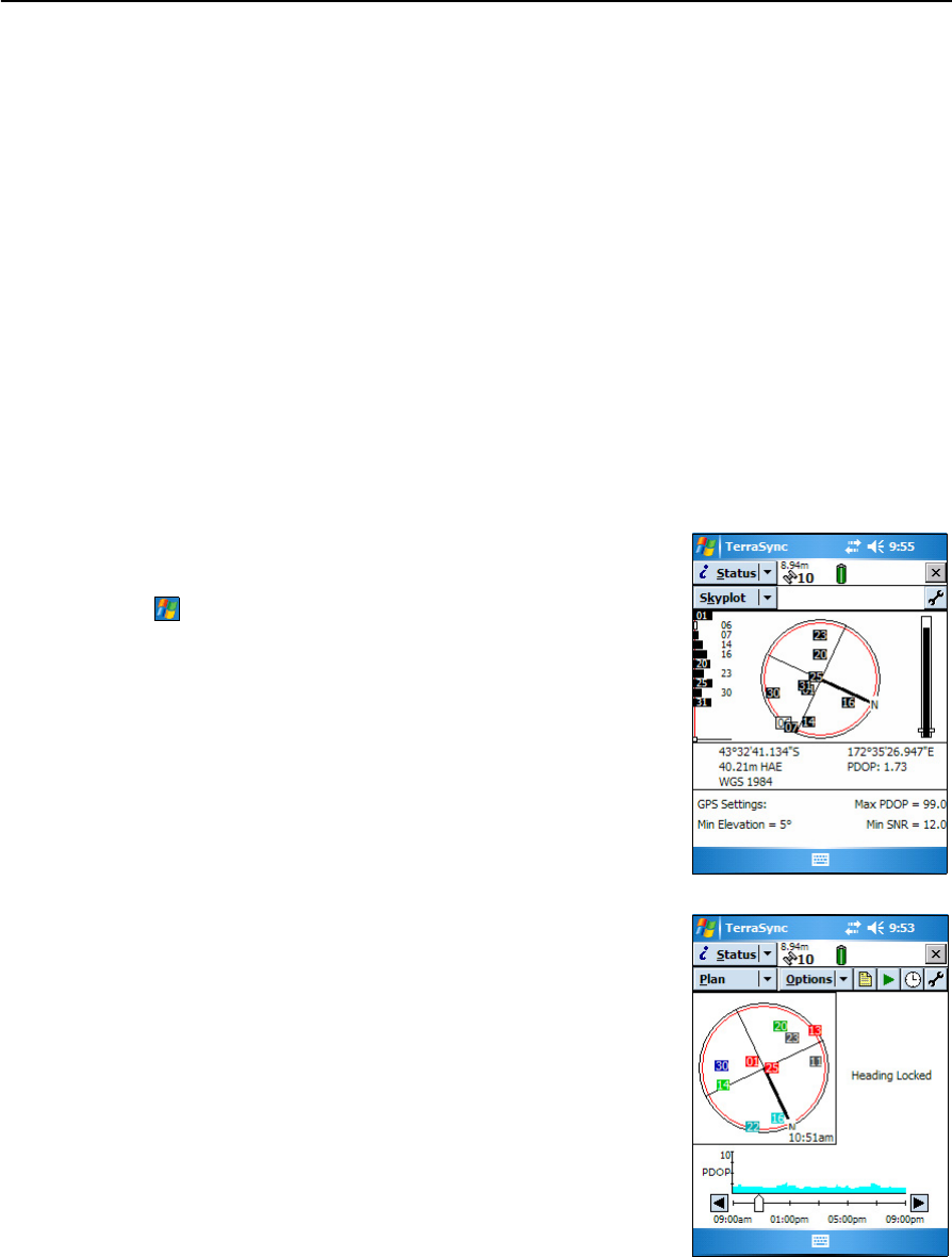
Viewing available satellites
To run the TerraSync software, tap
/ Programs / Terrasync.
The software opens, and by default displays the Skyplot
screen.
Use the Skyplot screen or the Satellite Info section to
view detailed GPS information about the GPS satellites
currently being tracked.
The area at the bottom of the screen shows the GPS
settings for the handheld’s GPS receiver.
Planning a data collection session
To maximize productivity, plan GPS data collection
around the times of the day when satellite geometry is
best. The TerraSync software includes a Plan section
with an animated skyplot and DOP (satellite geometry)
graph for your position for the next 12 hours.
In the Plan section, you can check the planning skyplot
as you play a session, then use the timeline to zoom in
on times when geometry is good, and you will be able to
collect plenty of GPS data.