


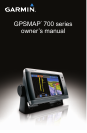

GPSMAP 700 Series Owner’s Manual 5
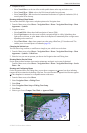
Charts and 3D Chart Views
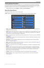
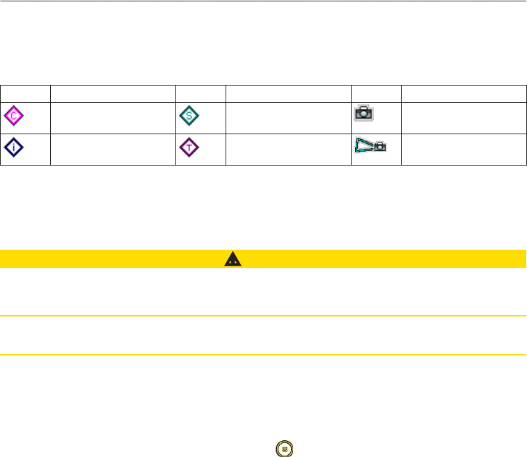
Chart Symbols
BlueChart g2 and BlueChart g2 Vision charts use graphic symbols to denote map features, which follow the
standards for US and international charts. Some other common symbols you might see include, but are not
limited to, those shown below.
Icon Description Icon Description Icon Description
Current station Marine services Overhead photo
available
Information Tide station Perspective photo
available
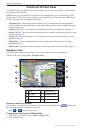
Other features common to most charts include depth contour lines (with deep water represented in white),
intertidal zones, spot soundings (as depicted on the original paper chart), navigational aids and symbols,
obstructions, and cable areas.
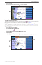
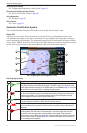
Navigating to a Point on the Chart
CAUTION
The Auto Guidance feature of the BlueChart g2 Vision data card is based on electronic chart information. That
data does not ensure obstacle and bottom clearance. Carefully compare the course to all visual sightings and
avoid any land, shallow water, or other obstacles that may be in your path.
When using Go To, a direct course and a corrected course may pass over land or shallow water. Use visual
sightings and steer to avoid land, shallow water, and other dangerous objects.
: The Fishing chart is available if you use a BlueChart g2 Vision SD card or a BlueChart g2 SD card, or
if your built-in map supports Fishing charts.
1. From the Home screen, select .
2. Select or .
3. Touch the chart to select the location using the cursor ( ).
4. Select .
5. Complete an action:
• Select to navigate directly to the location.
• Select to create a route to the location, including turns (page 28).
• Select to use Auto Guidance (page 21).
6. Review the course indicated by the magenta line.
: When using Auto Guidance, a gray segment within any part of the magenta line indicates that Auto
Guidance cannot calculate part of the Auto Guidance line. This is due to the settings for minimum safe
water depth and minimum safe obstacle height (page 46).
7. Follow the magenta line, steering to avoid land, shallow water, and other obstacles.
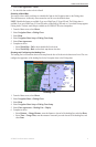
Panning the Navigation Chart, Fishing Chart, or Radar Overlay
You can pan away from your present location and to other areas on the Navigation chart, the Fishing chart, or
the Radar Overlay.
: The Fishing chart is available if you use a BlueChart g2 Vision SD card or a BlueChart g2 SD card,
or if your built-in map supports Fishing charts. The radar overlay is available when connected to a compatible
radar.
1. From the Home screen, select .
2. Select , , or .
3. Touch and drag the Navigation screen to pan the map.
When you pan past the edge of the map, the screen scrolls forward to provide continuous map coverage.
4. Select to stop panning and return the screen to your present location.