


4 GPSMAP 700 Series Owner’s Manual
Charts and 3D Chart Views
Charts and 3D Chart Views
The GPSMAP 700 series chartplotters have a basic imagery map. The charts and 3D chart views listed below
are available on the chartplotter.
: Mariner’s Eye 3D and Fish Eye 3D chart views are available only if you use a BlueChart g2 Vision
SD card (page 16). The Fishing chart is available if you use a BlueChart g2 Vision SD card or a BlueChart g2
SD card, or if your built-in map supports Fishing charts.
• —shows navigation data available on your pre-loaded maps and from supplemental
maps, if available. The data includes buoys, lights, cables, depth soundings, marinas, and tide stations in an
overhead view (page 4).
• —shows a view from above and behind your boat for a visual navigation aid (page 15).
• —shows a detailed, three-dimensional view from above and behind the boat for a visual
navigation aid (page 17).
• provides an underwater view that visually represents the sea oor according to the chart
information (page 18).
• —removes navigational data from the chart and enhances bottom contours for depth
recognition (page 19).
• —superimposes radar information on the Navigation chart or the Fishing chart (page 61).
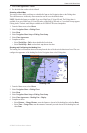
Navigation Chart
Use the Navigation chart to plan your course, to view map information, and as a navigational aid.
From the Home screen, select > .
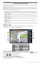
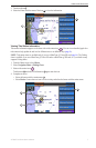
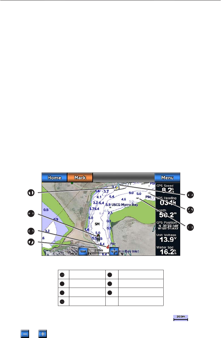
Navigation Chart with BlueChart g2 Vision Data
➎
➋
➌
➊
➐
➏
➍
➊
Light
➋
Marina services
➌
Your boat
➍
Submerged wreck
➎
Buoy
➏
Exposed wreck
➐
Zoom scale
Zooming In and Out on the Map
The zoom level is indicated by the scale number at the bottom of the Navigation chart ( ). The bar under
the scale number represents that distance on the map.
Select and to zoom out and zoom in.
Changing from One Chart to a Different Chart
1. From a chart or a 3D chart view, select > .
2. Select a different chart.