


48 GPSMAP 700 Series Owner’s Manual
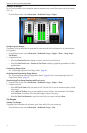
Device Conguration
Units of Measure
You can set the units of measure the chartplotter shows, using a standardized system of measurements or
creating a customized system of measurements.
Selecting a Standardized System of Measurement
1. From the Home screen, select > > .
2. Select (, , º), (, , º), or (, , º).
Creating a Customized System of Measurement
You must be receiving NMEA Sonar depth data or using an “S” series chartplotter (such as a GPSMAP 720s)
with a built-in sounder to view depth and temperature information.
You can select individual units of measure to create a customized system of measurement for your chartplotter
display.
1. From the Home screen, select > > > .
2. Complete an action:
• Select , and select ,, or.
• Select , and select or .
• Select , and select ,, or .
• Select > , and select , , or .
• Select > , and select , , or .
• Select , and select or .
• Select , and select , , or .
• Select > , and select or .
• Select > , and select or .
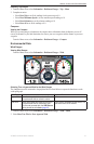
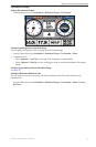
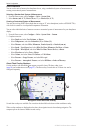
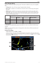
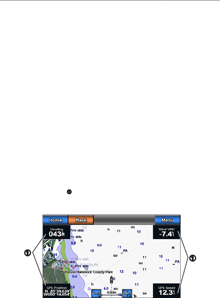
About Chart Overlay Numbers
Overlay numbers with data elds
➊
can appear on specic charts, 3D charts, radar views
(page 66), and combination screens (page 22). The data overlay for each chart or 3D chart view can be
congured separately.
➊
Navigation Chart with Data Overlay
➊
Several data overlays are available. You can select the data elds to be shown within each data overlay.
When overlay numbers are displayed on the chart, the navigation inset is shown during navigation. The
compass tape can be shown or hidden in each overlay.