


- 27 -
Guidance
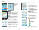
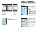
Tap Guidance. The settings under Speak Turn
Warning At determine how often and where
CoPilot will give you next turn information out
loud. All, none, or some boxes can be checked.
A pick list gives the options for Just Ahead: by
default you will be alerted 5 sec/100 ft before
every turn (5 seconds or 100 feet, whichever
is closest), but you can choose to have CoPilot
speak to you sooner (2 - 8 seconds before each
turn, or 100 feet).
The pick list under Custom Display give you
display options for the line above the ETA in the
screens. This line can display the destination, current road, nearest crossroad,
nearest major road, nearest town, current time, speed, elevation, or heading.
NOTE: Defaults are set here, but you can also toggle through the options by
tapping the line itself.
Check Display Route Arrow to have a yellow turn arrow appear on your route
on the map as you approach each turn (this option is turned on by default).
Check Amplify Speech Volume to have CoPilot speak louder (only active if the
TTS — text to speech — voice option was selected when CoPilot was installed).
Check Display GPS Arrow Trail to keep a trail of arrows that tracks your
position as you drive on the map.
10) Tap OK. Your new profile is now saved.
11) Check Confirm Profile when Routing
if you want to be prompted to select a profile
before each trip.
12) Choose a profile from the Road
Preference Profile pick list and tap OK. This
is the profile CoPilot will now use to calculate
routes.
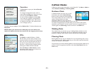
Stylus Control — Box Zoom is selected by default. It enables you to zoom into
an area on the map by drawing a box around it with the stylus. Selecting Drag Map
lets you use the stylus to drag the map in any direction to a desired location. Place
the stylus on the map and move it across the screen.
POI Display — Never: Never display POI's on map.
When Stopped: Display POI's when your vehicle is stopped.
Always: Always display POI's.
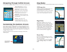
Automatic Day/Night Mode: With this option on, CoPilot automatically switches
between Day/Night Mode at daybreak and dusk. See Map Modes, p. 23.
Turn Restriction Display: Show/hide turn restrictions on the map.
Route Over: This setting affects how CoPilot's calculated route displays on the map.
When turned on, the route is outlined in black for better visibility.
NOTE: The list of Areas of Data shows which regions of map data are available.
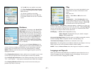
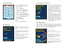
Language and Speech
When pre-recorded sound (OGG) files are installed, this option allows the user to
choose a language and select an available voice for that language. Use the up and
down arrows to choose a language, then tap OK.
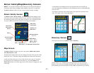
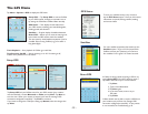
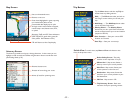
Map
Data areas that are currently downloaded to your
mobile device are shown at the bottom of this
screen.
Map options are:
Units — Select Mile or KM as the unit of
distance.
Map Rotation — Select Heading Up to have
the map display always track your position moving
upward (this is the default settings), or North Up
to maintain north at the top as you drive.