


74 Rino
®
120 Owner’s Manual
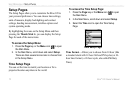
UNIT OPERATION > SETUP PAGES
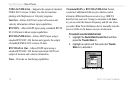
Position Format—Allows you to choose from different
grid formats. The default position format, ‘hddd°mm.
mmm’ displays the latitude and longitude in degrees
and minutes and is most commonly used. The following
additional formats are available:
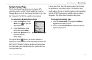
hddd.ddddd°—latitude/longitude in decimal degrees;
hddd°mm.mmm’—latitude/longitude in decimal
numbers; hddd°mm’ss.s”—latitude/longitude in degrees,
minutes, seconds; British Grid; Dutch Grid; EOV
Hungarian Grid; Finnish Grid; German Grid; Icelandic
Grid; India Zones; Irish Grids; Loran TD; Maidenhead;
MGRS; New Zealand; QNG Grid; RT90; South African
Grid; Swedish Grid; Swiss Grid; Taiwan Grid; US
National Grid; UTM/UpS—Universal Transverse
Mercator / Universal Polar Stereographic grids; W
Malayan RSO; and User UTM Grid.
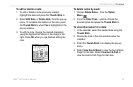
LORAN TD Format
When creating new waypoints using LORAN TD
coordinates, you must set the correct LORAN chain
number and secondary stations in the Setup TD field
before storing the waypoint. After the waypoint is stored
in unit memory, it always references the LORAN chain
number and secondary stations currently selected in the
Setup TD field. If you enter a different LORAN chain
number or change the secondary stations or offsets in the
Setup TD field, the active waypoint information reflects
those changes. Because the unit does not rely on the
LORAN signal for navigation, it can reference a different
GRI chain and/or secondary stations and still navigate to
the location stored in memory.
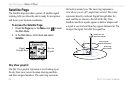
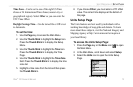
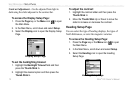
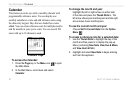
To adjust the Loran TD settings, select Loran TD
as the
Position Format to open the Loran TD setup window. To
change the settings of any fields, highlight the field, and
press the Thumb Stick In. When done, highlight Save
and press In.
For more information on Loran TDs, you may download
Garmin’s
Loran TD Position Format Handbook from
the Garmin Web site at http://www.garmin.com/support/
userManual.jsp.