


Rino 520HCx and 530HCx Owner’s Manual 33
BaSIc operatIon
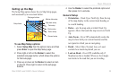
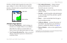
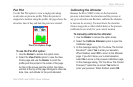
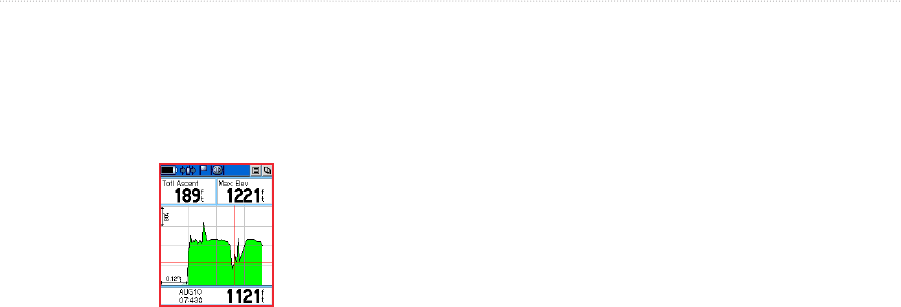
Pan Plot
Use the Pan Plot option to view a single point along
an elevation or pressure prole. When the pointer is
stopped at a location along the prole, the page shows the
elevation, time of day and date the point was created.
Pan Plot Option Page
To use the Pan Plot option:
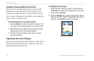
1. Use the Rocker to access the option menu.
2. Select the View Points option to view the View
Points page and use the Rocker to scroll the
prole past the pointer in the center of the page.
As the prole moves past the pointer, the status
window at the top of the page changes to show the
date, time, and altitude for the point indicated.
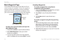
Calibrating the Altimeter
Because the Rino 530HCx relies on the barometric
pressure to determine the elevation and the pressure at
any given elevation can uctuate, calibrate the altimeter
to increase its accuracy. You must know the elevation
(from a map point or other reliable data) or the pressure
(calibrated to sea level) for your current location.
To manually calibrate the altimeter:
1. Use the Rocker to access the option menu.
2. Select the Calibrate Altimeter option to open the
Calibration page.
3. At the message asking “Do You Know The Correct
Elevation?” select Yes to enter your elevation.
When nished, select OK to return to the Altimeter
page. If you don’t know your current elevation,
select No to move to the pressure calibration page.
At the message asking, “Do You Know The Correct
Pressure?” select the on-screen Yes button to
enter your pressure. When nished, select OK.