


106
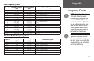
Appendix
Data Field Definitions
The following data field options are available on the Map, Navigation, Altimeter, and Trip
Computer Pages.
Ambient Pressure - The uncalibrated current pressure. (Altimeter Page Only.)
Average Ascent - The average vertical distance of ascents. (Altimeter Page Only.)
Average Descent - The average vertical distance of descents. (Altimeter Page Only.)
Barometer - The Calibrated current pressure. (Altimeter Page Only.)
Bearing - The direction from your current location to a destination.
Course - The direction from your starting location to a destination.
Current Destination - The next waypoint on your route.
Current Distance - The remaining distance to your next waypoint.
Current ETA - The estimated time of day you will arrive at your next waypoint.
Current ETE - The estimated time needed to arrive at the next waypoint on your route.
Elevation - The altitude (height) above or below sea level.
Final Destination - The last waypoint on your route.
Final Distance - The remaining distance to your final destination.
Final ETA - The estimated time of day you will reach your final destination.
Final ETE - The estimated time needed to reach your final destination.
GPS Accuracy - The estimated accuracy of the GPS signal.
Heading - Your moving direction.
Location (lat/lon) - Your current GPS position. (Trip Computer Page Only.)
Location (selected) - The lat/lon of point defined on map. (Trip Computer Page Only.)
Maximum Ascent - The maximum ascent rate in feet per minute. (Altimeter Page Only.)
Maximum Descent - The maximum descent rate in feet per minute. (Altimeter Page Only.)