


76 Rino
®
130 Owner’s Manual
UNIT OPERATION > SATELLITE PAGE
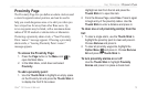
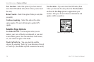
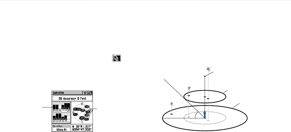
Satellite Page
The Satellite Page provides a picture of satellite signal
tracking, tells you when the unit is ready for navigation,
and shows your location coordinates.
To access the Satellite Page:
1. Press the Page button or the Menu icon to
open the Main Menu.
2. In the Main Menu, scroll down and select
Satellite.
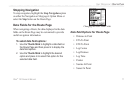
Satellite Page
Skyview
Graphic
Signal
Strength Bars
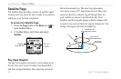
Sky View Graphic
The Sky View graphic represents a view looking up at
the sky from your current location showing satellites
and their assigned numbers. The outer ring represents
the horizon around you. The inner ring represents a
view above you at a 45° angle from vertical. The center
represents directly overhead. Signal Strength Bars for
each satellite are shown to the left of the Sky View.
Satellites and their signals appear as hollow shapes until
a signal is received and then they appear darkened in. The
stronger the signal, the taller the signal bar.
45°
90°
Outerring -
thehorizon
Innerring- 45°
abovethe horizon
Centerdot - 90°
abovethe horizon